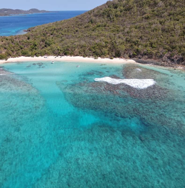
From Fajardo: Snorkeling and Beach Day in Culebra
A private speedboat for up to six: an hour snorkeling, then a beach BBQ.
From $1,500 per group, up to 6
Check AvailabilityBeyond the beaches, Culebra is a wildlife refuge, a marine reserve and an island that spent most of the last century as a Navy range. Here are the places worth knowing and how much of each a day trip shows you, before you choose a Culebra island tour.
Culebra is a municipality of Puerto Rico about 17 miles east of the main island. It covers 11.6 square miles and has about 1,900 residents. You reach it by boat or by a short flight, and there is no bridge and no car ferry for visitors.
Much of what you see from the water is protected. The refuge holds 21 cays around the island, and the channel off the west coast is a marine reserve. That is why the reefs and beaches look the way they do.
President Theodore Roosevelt founded the refuge in 1909. The U.S. Fish and Wildlife Service calls it the first national wildlife refuge in the Caribbean set up to protect native birds. Today it covers 1,510 acres, including 21 offshore cays.
Its public areas and hiking trails are open every day from 6am to 6pm. The refuge protects seabird colonies, three kinds of sea turtle, and two animals found almost nowhere else: the Culebra giant anole and the Virgin Islands tree boa. On a boat day you see it as green hills and rocky cays from the water.
Culebrita is the small island off Culebra's east coast, and it belongs to the refuge. On its hill stands the ruin of an old lighthouse, and around it are beaches the captains use when the sea is calm enough.
Two power boats list the Culebrita lighthouse on their routes, and the Puerto del Rey catamaran often ends its day on Culebrita's sand. You swim ashore from the boat, so wear water shoes and keep to the paths if you walk up.
The channel between Culebra and Cayo Luis Peña is a natural reserve. Puerto Rico's Planning Board designated it on 11 June 1999, and the natural resources department made it a no-take reserve, with no fishing, on 30 September 1999. The island's own fishers asked for it.
The reserve runs from the Flamenco Peninsula in the north to Punta Melones in the south. Several boats make their snorkel stop inside it, and the private charters name it on their route. When you snorkel here, you are swimming over a reef that nobody fishes.
The U.S. Navy used Culebra from the early 1900s, and from the late 1930s as a gunnery and bombing range. Training on the Flamenco Peninsula and the small islands ended in 1975. In 1976, parts of the land passed to Puerto Rico and to the Fish and Wildlife Service.
The rusting tank at the water's edge on Flamenco Beach is the most photographed relic of that time, now painted with graffiti. The Army Corps of Engineers still runs a munitions cleanup on parts of the island and its cays. If you see metal debris on a beach or a trail, leave it where it is and tell your crew.
More than 30,000 pairs of sooty terns nest on the Flamenco Peninsula, the refuge land behind Flamenco Beach. Roseate terns nest in the refuge too. The colony is one reason the peninsula stays closed land rather than open beach.
You see the birds from the beach and from the boat. Keep your distance from any nesting area and follow the refuge signs.
The island's town sits by the ferry dock, where the public ferry from Ceiba lands after its 1 hour 30 minute crossing. The Municipio de Culebra runs the island from here.
The ferry day's minibus takes you through town on the way to Tamarindo and Flamenco. The boat tours skip it and anchor off the beaches instead.
A day trip is a boat and a beach, not a tour of the island. This is what you see of each place, and how.
| Place | What it is | How a day trip reaches it |
|---|---|---|
| Culebra National Wildlife Refuge | U.S. Fish and Wildlife Service, since 1909 | From the boat; its trails 6am–6pm on your own |
| Culebrita and its lighthouse ruin | Part of the refuge | An afternoon stop on some boats |
| The Luis Peña reserve | No-take marine reserve, since 1999 | Snorkel stops on the private and power boats |
| The tank on Flamenco Beach | A relic of the Navy years | The ferry day and the Ceiba snorkel boat |
| The sooty tern colony | Refuge land on the Flamenco Peninsula | Seen from Flamenco Beach and the water |
| The town and the ferry dock | Municipio de Culebra | The ferry day's minibus passes through |
To walk the refuge trails at dawn or see the north-shore beaches, you need to stay the night or take the early ferry. The getting there page covers both.
The refuge, its species, the Navy history and its 1976 transfer are the U.S. Fish and Wildlife Service's statements; the population and area are the Puerto Rico government's.
A private speedboat for up to six: an hour snorkeling, then a beach BBQ.
From $1,500 per group, up to 6
Check Availability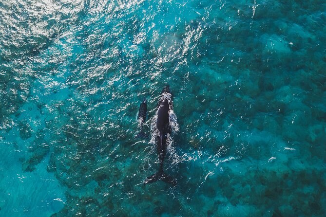
A power boat for 40 from Las Croabas: 1.5 hours moored on a reef, lunch and an open bar.
From $200 per person
Check Availability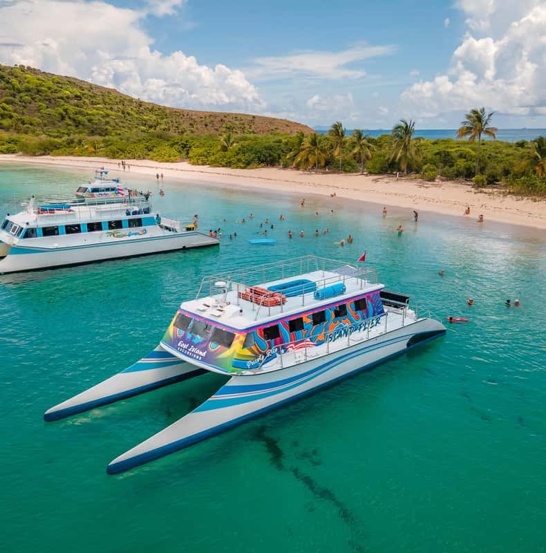
The high-speed catamaran day: a reef snorkel, lunch aboard, then Flamenco or Culebrita.
From $185 per person
Check AvailabilityThe beaches themselves are on the top beaches, the activities on things to do, and every tour is compared on Culebra Tours.